
Key Takeaways
A practical guide to reading a recorded plat, decoding its bearings, curve data and easement lines, and confirming which recorded version still controls your lot.
- A plat creates lots on paper and gets recorded; a boundary survey measures where those lines fall on the ground, and the two can disagree
- Bearings read in degrees, minutes and seconds, distances in feet and hundredths of a foot, and curves in central angle, arc length and radius
- In an aliquot land description, a comma means “and the” while no comma means “of the,” which can turn ten acres into 480
- A plat’s closure tolerance tests whether the numbers add up, not whether the lines sit correctly on the ground
- An amending plat can supersede yours without vacating it, so the sheet in your file may no longer be the controlling document
Plat maps tend to arrive at the worst moment. A title company emails a PDF, a seller hands over a folded sheet, and you are looking at a drawing covered in numbers like N 45°30’15” E, 150.00′ with no idea which matter.
The drawing is not decoration. Where land has been divided into lots, the recorded plat is the legal instrument that brought yours into existence, which is why your deed describes your property by lot, block, subdivision name, book and page.
This guide is for buyers and owners holding a plat they cannot read. Requirements are set state by state, so treat the rules below as worked examples.
Quick verdict: A plat map tells you what your lot is supposed to be. Only a current survey tells you where it is.
What is a plat map?
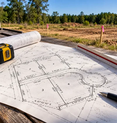
A plat map is a surveyor-prepared drawing that divides a tract into numbered lots and is recorded with the county to create them as legally described parcels. The word “plat” refers to that recorded instrument, not to any map of property lines.
Three things separate it from every other map of your land. A licensed surveyor certified it, a local government approved it, and it was recorded in the county’s land records, which gives it legal effect.
That recording is why your deed needs only one line. “Lot 7, Block 3, Meadow Ridge Addition, as recorded in Plat Book 42, Page 118” is a complete legal description because the plat carries the geometry.
Pulling the plat is one of the first moves in a purchase, which is why it belongs near the front of the sequence in our guide to how to buy vacant land.
What does a plat map show?
A plat shows the lots, blocks, streets, easements, monuments and dimensions defining a subdivision, plus the certifications that made it official. State statute sets the list, which is why plats from different states differ.
Minnesota’s plat content statute is unusually explicit and makes a good worked example. It requires the plat to “contain a complete and accurate description of each tract of land being platted,” and it dictates drafting conventions down to line style.
Lots and blocks are “numbered consecutively with Arabic numerals beginning with the numeral 1.” Leftover parcels get different treatment, labeled OUTLOT in capitals and “lettered consecutively in capital letters beginning with the letter ‘A.'”
Line style carries meaning. Solid lines are your lot, block and outlot boundaries, dotted lines are adjoining platted land, and dashed lines are drainage and utility easements, which means every dashed line on the sheet is an encumbrance.
How do you read the bearings, distances and curve data?
Every straight boundary segment carries a direction and a length, labeled per Minnesota’s statute “with the length of the line and bearing or azimuth.”
The direction is a bearing in degrees, minutes and seconds. N 45°30’15” E means: point north, then rotate 45 degrees, 30 minutes and 15 seconds toward the east. A minute is one sixtieth of a degree, a second one sixtieth of a minute, so that bearing is roughly 45.5 degrees east of north. Bearings run from north or south toward east or west, so none exceeds 90 degrees.
The length follows, “expressed in feet and hundredths of a foot.” Read the pair as an instruction: face the bearing, walk the distance, and you are at the next corner.
Curves need three numbers, because a bearing cannot describe an arc. Minnesota requires that “All curved line segments of the plat shall be labeled with the central angle, arc length, and radius length.” The radius, R=, runs from the circle’s center to the boundary. The central angle or delta, Δ=, is how many degrees of that circle the boundary sweeps. The arc length, L=, is the curved distance along it. Large radius and small angle is a gentle bend; small radius and large angle is the tight curve at a cul-de-sac.
Arc length is not the straight-line distance between the ends. That is the chord, always shorter, sometimes listed as CH=. A curve labeled nontangential does not meet the adjoining line smoothly, so there is a kink at the joint.
That gap matters on the ground. On a curved road the frontage figure is an arc, and the usable width where a building envelope sits can be narrower, which is one of the specifics in what to look for when buying land.
How do you read the legal description and the section grid?
Unplatted acreage is described by its position in the federal survey grid rather than by lot and block, under notation rules almost nobody explains. The BLM’s specifications for land descriptions set them out.
A description reads from the largest unit down: township, range, section, then subdivisions of the section. The BLM’s own example reads T. 4 N., R. 20 E., sec. 15, NW1/4, NE1/4SE1/4SW1/4, and NW1/4SE1/4.
Punctuation is where people lose hundreds of acres. In the BLM’s words, “A comma means ‘AND THE’ and the absence of a comma means ‘OF THE’.” So NE1/4SW1/4SE1/4 is the northeast quarter of the southwest quarter of the southeast quarter, ten acres. Add commas and NE1/4, SW1/4, SE1/4 becomes three separate quarter sections totaling 480 acres.
Two more rules matter. Aliquot descriptions “must not go beyond a four component description,” and “Lots cannot be described as aliquot.” Irregular parcels along a section’s north and west edges are numbered lots, written sec. 3, lot 1.
The grid itself is regular, and the BLM’s survey training materials give its dimensions. A township is six nominal miles square and holds thirty-six sections of one square mile each. One square mile is 640 acres, so a quarter section is 160 acres and a quarter-quarter is 40, which the BLM calls its standard land unit. Those are simply the sizes the grid produces, and they recur throughout rural legal descriptions. Section numbering snakes: it starts at 1 in the northeast corner, runs right to left, then left to right down the next row.
What is the difference between a plat map and a survey?
A plat map is a recorded document that creates lots. A boundary survey measures where one parcel’s lines fall on the ground today. One is a legal instrument, the other is current fieldwork.
| Plat map | Boundary survey | |
| Purpose | Divides a tract into lots, dedicates streets and easements | Locates one parcel on the ground |
| Scope | The whole subdivision | Usually one parcel |
| Recorded | Yes, which gives it effect | Often not |
| Age | As old as the subdivision | As of the fieldwork date |
| Shows occupation | No | Yes, fences, drives, encroachments |
| Where to get it | Public record, any county | Your surveyor or title company |
Both get called a “plat,” which is where confusion starts. The ALTA and NSPS standards refer to the survey deliverable as “the plat or map,” so a drawing labeled plat of survey is a survey product, with no subdivision approval behind it.
The distinction has teeth at the contract stage. Your land purchase agreement will almost certainly describe the property by its recorded plat reference, so you are buying the lot the plat defines, not the one a tape measure finds.
What do the easement and setback lines tell you?
Easement lines mark where someone else may use part of your lot, and they are easy to skim past. On a plat they are dashed and labeled with a purpose.
Minnesota requires easements dedicated on the plat to be shown “with purpose, identification,” plus enough data to locate their boundaries, and limits them to “drainage easements, public ways, and utility easements.”
The cost is arithmetic. On a 100 by 150 foot lot, 15,000 square feet in all, a ten-foot utility easement across the rear and a twenty-foot drainage easement down one side cover about 3,800 square feet once you account for the corner they share. Whether anything can be built on them is set by the easement’s own terms, and that is before any zoning setback applies.
Here is the trap. Minnesota provides that “Temporary easements, building setback information, and building floor elevations shall not be shown on a plat.” There, the absence of setback lines says nothing about whether setbacks exist; they live in the zoning ordinance. Other states do put them on the plat, which is why reading one on another state’s assumptions goes wrong.
Easements also surface late, in title work, which is why they feature in what to expect when you close on vacant land.
How accurate is a plat map?
A plat’s required accuracy is mathematical, not positional. The numbers must add up. Nothing promises the lines sit where the numbers say.
Minnesota sets the test directly: “The mathematical closure tolerance of the plat boundary, blocks, lots, and outlots shall not exceed 2/100 of a foot.” Walk the bearings around the perimeter on paper and you must land within two hundredths of a foot of your starting point. That checks the drafting, not reality.
The profession’s own standards assume record and ground will diverge. The 2021 ALTA and NSPS minimum standards require that where a measured dimension “differs from the record by an amount deemed significant by the surveyor, such dimension shall be shown in addition to, and differentiated from, the corresponding record dimension.” They also require “A note if the record description does not mathematically close.”
A standard that puts both numbers side by side was written expecting them to differ.
Then there is monument timing. Minnesota requires plat monuments “at all angle and curve points on the outside boundary lines of the plat prior to recording,” while interior lot and block corners may be set within one year after recording. So a plat can be recorded and lots sold before the pins marking individual corners exist.
How do you know your plat is still the controlling one?
A later amending plat can supersede yours without removing it from the record, so your sheet can look valid while no longer governing. Checking for a newer instrument is a separate step from reading the one you hold.
Texas Local Government Code 212.016 shows the mechanism plainly. An amending plat, once recorded, is “controlling over the preceding plat without vacation of that plat.” It is signed by the applicants only, and the statute states that “Notice, a hearing, and the approval of other lot owners are not required for the approval and issuance of an amending plat.”
The permitted purposes are not cosmetic. They include correcting an error in a course or distance, adding an omitted one, correcting a real property description, showing a monument that changed location, correcting lot-line courses and distances between adjacent lots where both owners join, and moving a lot line to clear an inadvertent building encroachment.
Read that list against the last few sections. The bearings you decoded, the distances you walked and the monuments you looked for are all things an amending plat can change, filed by someone else, with no notice to you, while the original sits in the record looking valid.
So ask the recorder or your title company for every instrument affecting the subdivision, not just the plat your deed names. This is general information, not legal advice; a real estate attorney in your state should confirm which instrument governs your lot.
What happens when a plat is replatted or vacated?
Whether an old plat must be formally killed before a new one takes effect depends on your state, and the two common approaches point in opposite directions. Texas, as above, lets an amending plat control without vacating it.
Michigan’s replat provision takes the opposite position. “A replat of all or any part of a recorded subdivision plat may not be approved or recorded unless proper court action has been taken to vacate the original plat or the specific part thereof,” with three exceptions. The first requires, among other conditions, that “all the owners of lots which are to be part of the replat agree in writing thereto,” that the agreement be recorded, and that there be “proof that notice to the abutting property owners has been given by certified mail.”
Same question, opposite answers. In Michigan the usual path needs a court to vacate the original and the neighbors to be told. In Texas the new instrument simply outranks the old one. Find out which rule governs your county before treating a plat as final.
What should you check before you rely on a plat map?
Work the document in a fixed order and most problems surface by themselves.
Confirm you have the official recorded version, which Minnesota requires be labeled OFFICIAL PLAT while copies are marked as copies. Read the title block for the subdivision name, recording book and page, surveyor certification and date. Find north and the graphic scale before interpreting any geometry. Identify your lot and block and trace its perimeter call-out by call-out, checking the dimensions against your deed and title commitment. Note every dashed easement and subtract it from your picture of the buildable area. Ask the recorder whether a later amending plat or vacation applies. Then decide whether the stakes justify a current survey.
When comparing parcels rather than studying one, the plat is the fastest way to tell a clean rectangular lot from one carved up by easements. Listings worth a second look tend to come from sellers who already have the paperwork assembled, one reason it pays to browse land listings from owners.
Frequently Asked Questions
How do I find the plat map for my property?
Start with the county recorder, register of deeds or clerk where the land sits, since that office holds the recorded plat and can provide a certified copy for a small fee. Many counties also publish plats through an online GIS parcel viewer. Your deed names the subdivision plus the book and page you need. A title company can also pull it.
What is the difference between a plat and a survey?
A plat is a recorded drawing that divides a tract into numbered lots and legally creates them. A boundary survey is current fieldwork locating one parcel’s lines on the ground, and it typically shows fences, drives and encroachments that no plat records. The plat defines what your lot is supposed to be; the survey finds where it actually is.
How accurate are plat maps?
Plat accuracy requirements are mathematical rather than positional. Minnesota, for example, requires closure tolerance not exceeding two hundredths of a foot, which only tests whether the dimensions add up. The 2021 ALTA and NSPS standards require surveyors to show a measured dimension alongside and differentiated from the record dimension whenever the two differ significantly.
What does OUTLOT mean on a plat map?
An outlot is a parcel inside a plat that is not a numbered buildable lot. It usually holds common area, stormwater facilities, open space or land reserved for later development. Minnesota requires outlots to be labeled OUTLOT in capitals and lettered consecutively starting at “A,” which is why they appear as Outlot A rather than by number.
Resources and Further Reading
- Minnesota Statutes 505.021, Plat Contents Statutory requirements for plat content, bearings, distances, curve data, line styles, easements and monuments.
- BLM Specifications for Descriptions of Land Official notation rules for aliquot land descriptions, including the comma convention and the four-component limit.
- 2021 ALTA and NSPS Minimum Standard Detail Requirements Professional standards governing how a survey reports differences between measured and record dimensions.
- Texas Local Government Code 212.016, Amending Plat The amending plat mechanism, its permitted purposes, and the absence of a notice requirement.
- Michigan Compiled Laws 560.104, Replat Michigan’s requirement that the original plat be vacated by court action before a replat, and the three exceptions.