Key Takeaways
How to screen a rural parcel from your desk, then inspect it properly on foot, and the findings that should end a purchase.
- Five things kill most rural deals: no legal access, ground that fails perc, floodplain, utilities miles away, and boundary disputes.
- You can check septic and foundation limitations for a specific parcel free on USDA Web Soil Survey before you ever drive out.
- Private wells are not regulated under the Safe Drinking Water Act. The owner is responsible for the water, and over 43 million Americans rely on one.
- Walk the whole parcel. The usable, buildable portion is what you are actually paying for, not the acreage on the deed.
- Visit after rain if you can. Drainage and road problems only show themselves when the ground is wet.
A rural parcel can look perfect in a listing and fail the moment you stand on it. The photos show the view. They do not show that the access road washes out in March, that the buildable ground is three acres of the twenty, or that the nearest power pole is a mile away.
This is the field inspection, in fifteen points, plus the desk screen that tells you which parcels are worth the drive in the first place. If you are earlier in the process, start with our guide to how to buy vacant land.
Quick verdict: screen soil, septic limitations and flood zone online before you commit a day to a viewing. On site, check access first, because a landlocked parcel is a dealbreaker no view can fix. Then water, drainage and utility distance. If access is clean, the ground drains and a well is realistic, most other problems are manageable and negotiable.
What Makes a Rural Inspection Different?
Everything you would normally take for granted has to be verified individually.
On a suburban lot the water main, the sewer, the power and the paved road already exist. On rural land each of those is a separate question with its own cost, and any one of them can make the parcel unbuildable. That is why this guide is organised around infrastructure rather than around general buying advice. If you are looking at a parcel where services are already present, our broader guide to what to look for when buying land covers the general considerations that apply to any parcel.
There is also a second half to this that happens at a desk rather than on the ground. Title, zoning, liens, permits and the survey are all paperwork, and they are covered in our raw land due diligence checklist. A parcel can pass the field walk and fail on paper, so treat the two as a pair.
What Should You Check Before You Drive Out?
Two free federal tools will eliminate a share of parcels before you spend a day on the road, and almost nobody uses them this way.
USDA Web Soil Survey. Most buyers treat this as a soil-type lookup. It is considerably more useful than that. USDA’s Natural Resources Conservation Service states that soil surveys help you evaluate where soil properties affect “the function of septic tank absorption fields, sewage lagoons, foundations, and landfills”, and that soil maps can show hazards “like flooding and water tables, that may damage structures or limit installations”.
That means you can pull the septic and foundation limitations for a specific parcel before you leave the house. It is not a substitute for a perc test, and a rating is not a permit, but a parcel rated severely limited for absorption fields deserves a phone call to the county health department before it deserves a three-hour drive.
The FEMA Flood Map Service Center. The official public source for flood hazard information under the National Flood Insurance Program, searchable by address or coordinates. A Special Flood Hazard Area is defined in federal regulation as land “subject to a 1 percent or greater chance of flooding in any given year”, so knowing whether the parcel sits inside one is a two-minute check that changes what it is worth.
Screen at the desk, then walk the survivors. On rural land that ordering saves entire days.
What Do You Check First On Site?
Access, before anything else. A parcel you cannot legally reach is close to worthless regardless of what else is right about it.
1. Legal and physical access. Physical access means a driveable route reaches the parcel. Legal access means you hold a recorded right to use it, through public road frontage or a deeded easement. A parcel can have an obvious dirt track and still be landlocked on paper. If the only way in crosses a neighbour’s ground with nothing recorded, treat that as a stop until the title work says otherwise.
2. Road condition and year-round access. Drive the full approach yourself and look for washouts, deep ruts, steep unpaved grades and low water crossings. Ask who maintains the road and whether it is county-maintained or a private road you would help pay for. A route that is fine in July and impassable in March affects deliveries, emergency access and resale.
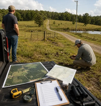
3. Boundaries and corner markers. Walk the perimeter with the plat and a GPS app and find the pins. Fences, driveways and outbuildings sitting in the wrong place are common on rural land, and boundary confusion is how buyers discover a parcel is smaller or differently shaped than advertised. If you cannot find the corners, plan on a survey before closing.
What Does the Ground Tell You?
Walk the whole parcel, not the road frontage. The usable portion is what you are paying for.
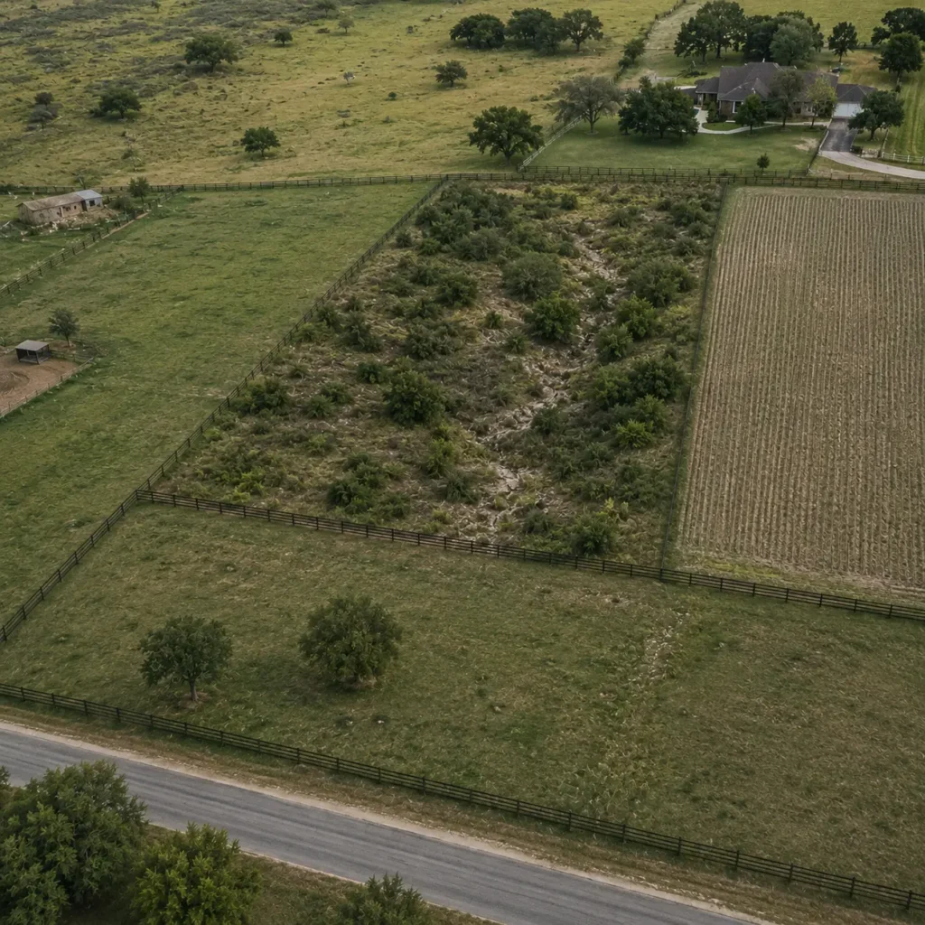
4. Buildable area and topography. Find the level to gently sloping ground with good drainage that could hold a house, a barn and a septic field. Note the steep slopes, rock outcrops, ravines and low wet areas that subtract from it. Twenty acres with three flat dry acres prices closer to a small lot than a large tract, and hillside building adds retaining walls, longer driveways and engineered foundations.
5. Water sources and drainage. Look for existing wells, springs, ponds or creeks, and ask what the neighbours use and how deep their wells run, because drilling cost rises with depth. Then read the drainage: standing water, cattails and soggy ground signal wetlands or poor drainage, while gullies and bare eroded soil signal runoff.
The regulatory position on rural water is worth knowing before you rely on a well. The EPA states that the quality and safety of private well water are “not regulated by the Federal Government under the Safe Drinking Water Act nor by most state governments and laws”, and that “private well owners are responsible for delivering safe drinking water to their households”. Around 15 percent of the US population, over 43 million people, live with that arrangement. It is entirely normal and it is entirely yours to manage.
6. Soil. Take a shovel and dig. Topsoil over workable earth is one proposition; thin dirt over solid rock is another, and it raises the cost of wells, foundations and trenching alike. Confirm what you found against the Web Soil Survey data you pulled before the visit.
7. Flood and erosion evidence. Look for debris lines on trees and fences, water-stained rocks, fresh silt, carved gullies and vegetation that only grows in wet ground. These record where water has actually been, whatever the seller says, and they should match the flood map you already checked.
What Will Services Cost Out Here?
This is where rural parcels become expensive after the purchase rather than during it.
8. Utility distance. Find the nearest power pole and measure. Do not accept a rule of thumb for what a line extension costs, because rural electric co-ops quote per foot against the specific parcel and the number varies enormously by terrain and distance. Call the co-op with the parcel number and get it in writing before you make an offer. If the answer makes conventional building uneconomic, the parcel may still work as off-grid land, which is a different plan rather than a failure.
9. Cell signal and internet. Check your bars in several spots while you are standing there. Ask locally about fixed wireless and satellite. For recreational ground this matters little; for a homesite or anyone working remotely it is a genuine constraint, and it is far easier to test now than to discover after you build.
10. Septic feasibility. Rural land almost never has municipal sewer. More than one-fifth of US households use an individual onsite or small community cluster septic system, and the EPA notes these systems suit “sparsely populated areas” precisely because there is no alternative. The test that matters is the percolation test, which measures how fast the ground drains. Ask whether one has been done, and if not make your offer contingent on a passing result. Setbacks and system requirements are set by the county, so call the local health department rather than assuming.
What Surrounds the Parcel?
You are buying the neighbourhood as much as the ground.
11. Neighbours and surrounding land use. Drive the area. Well-kept homesteads, active farms, industrial operations, quarries, feedlots and shooting ranges all change what living there is like and what the parcel resells for. Look for survey stakes, new roads or utility expansion on adjoining land, which usually mean development is coming.
12. Trees and vegetation. Marketable timber is a real asset; dense brush and invasives are a clearing cost before you can build. Vegetation also describes the site: cattails and willows mean wet ground, healthy hardwoods suggest decent soil, and heavy brush near a building site raises wildfire risk and insurance cost in fire-prone regions.
13. Wildlife and recreation. Game trails, tracks, rubs and water sources tell you what the parcel supports, which matters if hunting or recreation is part of why you are buying. The same features can cut the other way: protected species habitat and wetlands that attract waterfowl can both restrict what you are permitted to do.
14. Easements and encroachments. Power lines, pipelines, worn paths and shared driveways usually mean someone else holds rights across the land. A neighbour’s fence, shed or drive sitting over the line is the mirror image. Neither necessarily kills a deal, but a utility easement can dictate where you build and a shared road normally comes with shared maintenance. Photograph everything crossing the parcel and check it against the title work.
15. Noise and smells. Stand still and listen. Highway, rail, aircraft, a gun range, an industrial hum. Then smell the air for feedlots, landfills and agricultural odour. Visit at a different time of day if you can. None of this appears in a listing and all of it shapes daily life.
What Should Make You Walk Away?
Four findings are usually terminal.
No legal access and no realistic route to an easement. Everything else is negotiable. This is not.
The only buildable ground sits inside a Special Flood Hazard Area. Building restrictions and insurance requirements follow the land.
Failed perc with no affordable engineered alternative. If you intend to build a home, this ends it.
An active boundary or title dispute. You are buying somebody else’s litigation.
Add to those a connection cost that exceeds what the land is worth, visible evidence of contamination, and a seller who will not answer direct questions about access, water or liens. Being willing to walk is what lets you buy the next one with confidence, and if you want a second opinion on a specific parcel you can contact us.
The Rural Inspection Scorecard
Rate the parcel after the visit. A failure in any of the first three rows should stop you.
| Inspection point | Pass | Red flag |
| Legal access | Recorded frontage or deeded easement | Landlocked, nothing recorded |
| Flood and drainage | Outside the SFHA, sheds water | Inside the SFHA, standing water |
| Septic and soil | Passing perc, workable soil | Failed perc, rock near surface |
| Road and access | County-maintained, year-round | Seasonal, washed out |
| Utility distance | Power at or near the road | Miles from service, no written quote |
| Boundaries | Corners found, match the plat | Missing pins, fence disputes |
| Water | Neighbouring wells at workable depth | No known source, deep or dry wells nearby |
| Surroundings | Compatible neighbours | Feedlot, quarry, junk lots |
What Do You Do After the Visit?
Confirm on paper what your eyes suggested, because the two have to agree before you close.
Order or review the title search, the recorded survey, the zoning and permitted uses, any liens or back taxes, and the flood and soil reports. Compare your inspection notes against the documents line by line, and make the offer contingent on a survey and a perc test if those are not already done.
When the parcel clears, our guide to how to make an offer on vacant land covers structuring the contingencies so your inspection findings actually protect you.
Sanity-check the asking price too. Compare it against similar acreage on our land marketplace in the same county, matched on access and services, rather than against whatever listing happens to sit next to it.
Screen First, Then Walk
The buyers who do well on rural land are not the ones who see the most parcels. They are the ones who eliminate the wrong parcels at a desk and spend their driving time on the shortlist.
Ready to find parcels worth visiting? Start your free trial and filter by county, acreage and price before you plan a single trip.
Frequently Asked Questions
What is the most important thing to check when buying rural land?
Legal access. A parcel with no recorded right of access is extremely hard to build on, finance or resell, and a visible dirt track is not proof of one. You need public road frontage or a deeded easement in writing. Confirm it on the ground during your visit and again in the title search before closing.
Do I need a perc test before buying rural land?
If you intend to build and there is no municipal sewer, yes. The percolation test determines whether the ground can support a septic system, and more than one-fifth of US households rely on one. If the seller has not done a test, make your purchase contingent on a passing result. Failed perc can mean an engineered system or no home at all.
How do I check if rural land floods before I visit?
Search the parcel on the FEMA Flood Map Service Center, the official public source for flood hazard information. A Special Flood Hazard Area is land with a 1 percent or greater chance of flooding in any given year. On site, confirm it against debris lines, silt deposits, erosion gullies and water-loving plants.
Is well water on rural land safe to drink?
It can be, but nobody is checking it for you. The EPA states private well water is not regulated under the Safe Drinking Water Act or by most states, and that the owner is responsible for delivering safe water to the household. Over 43 million Americans rely on private wells. Test before you rely on one.
What is the difference between a land inspection and due diligence?
The inspection is the physical site visit: access, water, soil, terrain and surroundings, checked with your own eyes. Due diligence is the paperwork: title, zoning, liens, permits and the survey, handled from your desk and through professionals. You need both, because a parcel can walk well and still fail on paper.
Resources and Further Reading
- USDA NRCS: Soil Surveys Can Help You explains how soil survey data covers septic absorption fields, foundations and soil-related hazards.
- EPA: Private Drinking Water Wells confirms that private wells are not regulated under the Safe Drinking Water Act and that owners are responsible for water safety.
- EPA SepticSmart reports that more than one-fifth of US households use an onsite or cluster septic system.
- FEMA Flood Map Service Center is the official public source for flood hazard information and lets you check a parcel by address.
- 44 CFR 59.1 gives the federal definition of an area of special flood hazard as land with a 1 percent or greater annual chance of flooding.